|
There was a need to know a bit more about the site. Ever ready to help Flic and Jem turned to Minecraft. They used a map created by the British Geology Society in collaboration with Ordnance Survey to look at the geology of our site. It covers the whole of Britain, but due to the scale it was very difficult to navigate using the roads as they tended to merge in the towns and cities. So ever resourceful Jem made a boat and navigated there from The Wash using the rivers and dykes. It took us awhile to find the position of our site. On this the Orange/pumpkins are West street, to give you an idea of scale. We dug down...........and were worried ..........as there was only a void 1 block (a metre) down, we were concerned for the foundations :-( Daddy thought that wasn't enough information so he commissioned a topographical survey (Not as much fun but still quite colouful) : 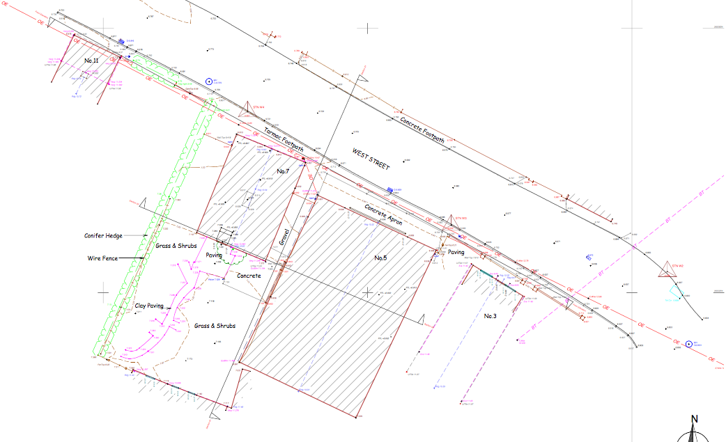 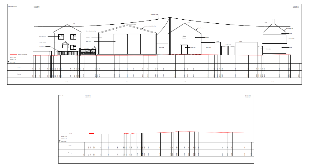
0 Comments
|
